| Listing 1 - 10 of 26 | << page >> |
Sort by
|
Book
ISBN: 3598203748 0862912962 3111839095 3110976005 9783110976007 9780862912963 9783598203749 9783598203749 Year: 1986 Volume: 31 Publisher: München New York
Abstract | Keywords | Export | Availability | Bookmark
 Loading...
Choose an application
- Reference Manager
- EndNote
- RefWorks (Direct export to RefWorks)
Map collections --- Cartothèques --- Directories --- Répertoires --- 026:912 --- Speciale bibliotheken-:-Cartografie. Kaarten. Plattegronden. Atlassen --- 026:912 Speciale bibliotheken-:-Cartografie. Kaarten. Plattegronden. Atlassen --- Cartothèques --- Répertoires --- Cartes. Collections. (Répertoire) --- Kaarten. Verzamelingen. (Repertorium) --- Map libraries --- Special libraries --- History.

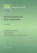
ISSN: 03446891 ISBN: 3598218184 311095043X 9783110950434 9783598218187 Year: 2000 Volume: 92-93 Publisher: München K.G. Saur
Abstract | Keywords | Export | Availability | Bookmark
 Loading...
Choose an application
- Reference Manager
- EndNote
- RefWorks (Direct export to RefWorks)
The World Directory of Map Collections.
Map collections --- Cartothèques --- 026:912 --- Map libraries --- Speciale bibliotheken-:-Cartografie. Kaarten. Plattegronden. Atlassen --- 026:912 Speciale bibliotheken-:-Cartografie. Kaarten. Plattegronden. Atlassen --- Cartothèques --- 912 --- Special libraries --- Geodesy. Cartography --- Documentation and information --- Directories --- Répertoires --- Libraries --- Special collections --- Cartes --- Map collections - Directories
Book
ISBN: 9781108431828 9781107036673 1108431828 1107036674 1316547442 1316547116 1316547779 1316549429 1316548104 1139568124 131654513X 9781316548103 9781316549421 9781139568128 9781316549094 1316549097 Year: 2016 Publisher: Cambridge : Cambridge University Press,
Abstract | Keywords | Export | Availability | Bookmark
 Loading...
Choose an application
- Reference Manager
- EndNote
- RefWorks (Direct export to RefWorks)
Giants, cannibals and other monsters were a regular feature of Renaissance illustrated maps, inhabiting the Americas alongside other indigenous peoples. In a new approach to views of distant peoples, Surekha Davies analyzes this archive alongside prints, costume books and geographical writing. Using sources from Iberia, France, the German lands, the Low Countries, Italy and England, Davies argues that mapmakers and viewers saw these maps as careful syntheses that enabled viewers to compare different peoples. In an age when scholars, missionaries, native peoples and colonial officials debated whether New World inhabitants could - or should - be converted or enslaved, maps were uniquely suited for assessing the impact of environment on bodies and temperaments. Through innovative interdisciplinary methods connecting the European Renaissance to the Atlantic world, Davies uses new sources and questions to explore science as a visual pursuit, revealing how debates about the relationship between humans and monstrous peoples challenged colonial expansion.
Cartography --- Geography --- Monsters --- Symbolic aspects of monsters --- Symbolism --- Cosmography --- Earth sciences --- World history --- Cartography, Primitive --- Chartography --- Map-making --- Mapmaking --- Mapping (Cartography) --- Mathematical geography --- Surveying --- Map projection --- Maps --- History --- Sociological aspects --- Symbolic aspects --- 912:325 --- 912:930 --- 930.85 "15/17" --- 391/397 --- 391/397 Ethnografie --- Ethnografie --- Cartografie. Kaarten. Plattegronden. Atlassen-:-Landverhuizing. Kolonisatie. Immigratie. Emigratie --(politiek) --- Cartografie. Kaarten. Plattegronden. Atlassen-:-Geschiedwetenschap. Hulpwetenschappen der geschiedenis --- Cultuurgeschiedenis. Kultuurgeschiedenis--Moderne Tijd --- 930.85 "15/17" Cultuurgeschiedenis. Kultuurgeschiedenis--Moderne Tijd --- 912:930 Cartografie. Kaarten. Plattegronden. Atlassen-:-Geschiedwetenschap. Hulpwetenschappen der geschiedenis --- 912:930 Cartography. Maps. Atlasses-:-Geschiedwetenschap. Hulpwetenschappen der geschiedenis --- Cartography. Maps. Atlasses-:-Geschiedwetenschap. Hulpwetenschappen der geschiedenis --- 912:325 Cartografie. Kaarten. Plattegronden. Atlassen-:-Landverhuizing. Kolonisatie. Immigratie. Emigratie --(politiek) --- 912:325 Cartography. Maps. Atlasses-:-Landverhuizing. Kolonisatie. Immigratie. Emigratie --(politiek) --- Cartography. Maps. Atlasses-:-Landverhuizing. Kolonisatie. Immigratie. Emigratie --(politiek) --- Western Hemisphere --- Cartography - Europe - History - 16th century --- Cartography - Europe - History - 17th century --- Geography - Sociological aspects --- Monsters - Symbolic aspects --- Western Hemisphere - Maps --- Sociological aspects. --- Hemisphere, Western --- New World --- Earth (Planet)
Book
ISBN: 9789004440098 9004440097 9789004439856 9004439854 Year: 2021 Publisher: Leiden ; Boston : Brill,
Abstract | Keywords | Export | Availability | Bookmark
 Loading...
Choose an application
- Reference Manager
- EndNote
- RefWorks (Direct export to RefWorks)
In Picturing the Islamicate World, Nadja Danilenko explores the message of the first preserved maps from the Islamicate world. Safeguarded in al-Iṣṭakhrī's Book of Routes and Realms (10th century C.E.), the world map and twenty regional maps complement the text to a reference book of the territories under Muslim rule. Rather than shaping the Islamicate world according to political or religious concerns, al-Iṣṭakhrī chose a timeless design intended to outlast upheavals. Considering the treatise was transmitted for almost a millennium, al-Iṣṭakhrī's strategy seems to have paid off. By investigating the Persian and Ottoman translations and all extant manuscripts, Nadja Danilenko unravels the manuscript tradition of al-Iṣṭakhrī's work, revealing who took an interest in it and why.
Cartography --- Cartography, Primitive --- Chartography --- Map-making --- Mapmaking --- Mapping (Cartography) --- Mathematical geography --- Surveying --- Map projection --- Maps --- History --- Iṣṭakhrī, Ibrāhīm ibn Muḥammad, --- Geography, Arab. --- E-books --- 912:297 --- 091 "04/09" --- 091 "04/09" Handschriftenkunde. Handschriftencatalogi--5e/10e eeuw. Periode 0400-0999 ('vroege middeleeuwen') --- Handschriftenkunde. Handschriftencatalogi--5e/10e eeuw. Periode 0400-0999 ('vroege middeleeuwen') --- 912:297 Cartografie. Kaarten. Plattegronden. Atlassen-:-Islam. Mohammedanisme --- 912:297 Cartography. Maps. Atlasses-:-Islam. Mohammedanisme --- Cartografie. Kaarten. Plattegronden. Atlassen-:-Islam. Mohammedanisme --- Cartography. Maps. Atlasses-:-Islam. Mohammedanisme --- History. --- Islamic countries --- Historical geography. --- Arabic literature --- Geography --- History of civilization --- History of Asia --- anno 1400-1499 --- Cartography. --- Cartographie --- Géographie arabe --- Iṣṭaẖrī, Ibrāhīm ibn Muḥammad al-, --- Pays islamiques. --- Geography, Arab --- Iṣṭakhrī, Ibrāhīm ibn Muḥammad, -957 or 958. Masālik wa-al-mamālik
Periodical
ISSN: 03085694 14797801 Year: 1935 Publisher: Berlin
Abstract | Keywords | Export | Availability | Bookmark
 Loading...
Choose an application
- Reference Manager
- EndNote
- RefWorks (Direct export to RefWorks)
Imago Mundi is the only English-language scholarly periodical devoted exclusively to the history of pre-modern maps, mapping, and map-related ideas from anywhere in the world. It was founded in Berlin in 1935 by the Russian émigré Leo Bagrow as an annual publication, although only five volumes appeared between 1935 and 1948. From 1975 to 2003 publication was regular. In 2004 Imago Mundi became a biannual publication. The first volume was in German. Thereafter English was used with, very occasionally, French. After 2002 (volume 54) Imago Mundi publishes exclusively in English with foreign language abstracts (currently French, German, and Spanish). A multi-disciplinary approach was adopted in 1995. All articles represent original research, are refereed, and are well illustrated (recent volumes have included color plates). Since 1977 each volume has contained a full complement of scholarly aids in the form of book reviews, bibliography, and chronicles, all of which have made Imago Mundi a valuable journal of record as well as scholarship.
cartografie --- Cartography --- Early maps --- Cartographie --- Cartes anciennes --- Architecture, Fine and Decorative Arts. --- Arts and Humanities. --- Arts and Humanities --- Earth Sciences --- Architecture, Fine and Decorative Arts --- History --- Geodesy. Cartography --- 912 <09> --- 912 <05> --- Cartografie. Kaarten. Plattegronden. Atlassen--Geschiedenis van ... --- Cartografie. Kaarten. Plattegronden. Atlassen--Tijdschriften --- Periodicals --- Cartography. --- Early maps. --- History (General) --- Geography & Cartography. --- Maps, Early --- Geography --- Cartography, Primitive --- Chartography --- Map-making --- Mapmaking --- Mapping (Cartography) --- Mathematical geography --- Surveying --- Map projection --- Maps --- cartography [discipline] --- Cartografie. Kaarten. Plattegronden. Atlassen--Geschiedenis van .. --- Cartografie. Kaarten. Plattegronden. Atlassen--Geschiedenis van . --- Cartografie. Kaarten. Plattegronden. Atlassen--Geschiedenis van --- Cartography - Periodicals. --- Early maps - Periodicals. --- Cartographie - Périodiques. --- Cartes anciennes - Périodiques.
Book
ISBN: 9782868203748 2868203744 9791034404261 Year: 2008 Volume: 15 Publisher: Strasbourg: Presses universitaires de Strasbourg,
Abstract | Keywords | Export | Availability | Bookmark
 Loading...
Choose an application
- Reference Manager
- EndNote
- RefWorks (Direct export to RefWorks)
Si la production cartographique se diversifie au cours des xviie et xixe siècles, les usages des cartes font de même : usages administratifs, savants, mais aussi démonstratifs, rhétoriques, etc., les uns n'excluant évidemment pas les autres. C'est en traitant de front les opérations techniques de production des cartes et les pratiques de leur consultation que les auteurs de cet ouvrage proposent d'aborder l'histoire de la cartographie. Cette approche pragmatique permet de se démarquer du « paradigme empirique » de l'histoire de la cartographie. Elle souligne qu'une carte offre des images du territoire variables selon la communauté d'usagers à qui elle est destinée.
Cartography --- Map drawing --- Map reading --- Cartographie --- Cartes géographiques --- Lecture de cartes --- History --- Histoire --- Dessin --- Maps --- History 17th century --- History 18th century --- History 19th century --- History 17th century. --- History 18th century. --- History 19th century. --- 912 <063> --- 912 <09> <44> --- Cartography. Maps. Atlasses--Congressen --- Cartografie. Kaarten. Plattegronden. Atlassen--Geschiedenis van ...--Frankrijk --- Cartes géographiques --- Cartography, Primitive --- Chartography --- Map-making --- Mapmaking --- Mapping (Cartography) --- Mathematical geography --- Surveying --- Map projection --- Maps - History - 17th century --- Maps - History - 18th century --- Maps - History - 19th century --- Cartography - History 17th century --- Cartography - History 18th century --- Cartography - History 19th century --- cartographie --- histoire --- histoire contemporaine

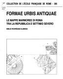
ISBN: 2728305579 2821820690 2728310238 9782728305575 Year: 2002 Volume: 305
Abstract | Keywords | Export | Availability | Bookmark
 Loading...
Choose an application
- Reference Manager
- EndNote
- RefWorks (Direct export to RefWorks)
Se è vero che la Forma Vrbis Marmorea di età severiana (inizio III sec.) continua ad essere la « forma » per eccellenza, ciò è dovuto, soprattutto, alla sua consistenza fisica (centinaia di frammenti che definiscono buona parte della topografia urbana) ; ma non è meno vero che frammenti minori di altre mappe, dall’origine e scopi diversi (sostanzialmente amministrativi), siano arrivati fino a noi, apportando nuovi dati tecnici ed interrogativi non sempre facilmente risolvibili. Negli ultimi vent’anni, alcuni di essi sono venuti alla luce nei più svariati contesti archeologici urbani, evidenziando quanto questa prassi cartografica fosse diffusa per ragioni soprattutto catastali e amministrative. Una osservazione fondamentale che scaturisce da questi documenti « minori » consiste nel fatto che attraverso di essi si intuisce un sistema cartografico riconducibile ad Augusto e alla sua opera di rinnovamento amministrativo della città. Una analisi comparativa di una certa ampiezza di tutti questi documenti viene ora tentata in modo esplorativo, ivi compresi i documenti grafici relativi a certi servizi come gli acquedotti extraurbani nella loro funzione di irrigazione dei fondi rustici. Come e fino a che punto questi documenti cartografici di grande impegno e, a volte, raffinatezza, dipendano da uno studio su base trigonometrica e, forse, astronomico-proiettiva, è uno degli aspetti più affascinanti e meno esplorati che attendono dagli studiosi nuove osservazioni ed approfondimenti.
Cartography --- Rome (Italy) --- Antiquities --- -912.45 --- 937.6 --- Cartography, Primitive --- Chartography --- Map-making --- Mapmaking --- Mapping (Cartography) --- Mathematical geography --- Surveying --- Map projection --- Maps --- History General geography Atlases Maps Charts Plans Italy --- History Ancient world Italy Rome --- -Rome (Italy) --- -Antiquities --- 912.45 --- Rome (Italy : Commune) --- Rome (Italy : Governatorato) --- Rūmah (Italy) --- Roma (Italy) --- Rom (Italy) --- Rím (Italy) --- Rzym (Italy) --- Comune di Roma (Italy) --- Rome --- Antiquities. --- Geography --- Earth & Environmental Sciences --- Cartographie --- Rome (Italie) --- Cartes --- Antiquités --- To 1800 --- Rome (Italy : Comune) --- Cartography - Rome. --- Rome (Italy) - Maps - To 1800 --- Rome (Italy) - Antiquities --- repubblica --- forma urbis
Multi
ISBN: 9020948539 9789020948530 Year: 2002 Publisher: Brussel Nationaal Geografisch Instituut
Abstract | Keywords | Export | Availability | Bookmark
 Loading...
Choose an application
- Reference Manager
- EndNote
- RefWorks (Direct export to RefWorks)
Cet atlas contient la cartographie digitale la plus récente de la Belgique: cartes d'Etat major, à l'échelle détaillée et qui comportent de nombreux symboles, index complet. Cette cartographie est la meilleure au monde.
Belgium --- Cartographie --- Topographie --- Belgique --- België --- Aardrijkskunde --- Atlassen. --- Atlas --- Géographie --- topography [image-making] --- België ; topografische kaarten --- 528.93 --- 912 <493> --- C3 --- België [land - BE] --- topografie --- atlassen --- 912 --- Topografie --- 910 --- toeristische topografie --- 528 ) Apparaten voor topografie --- 980.6 --- België - atlas --- België: atlassen --- België: topografie --- 528.93 Topographic cartography. Chorographic cartography (landscape cartography). Representation of place and space --- Topographic cartography. Chorographic cartography (landscape cartography). Representation of place and space --- Cartografie. Kaarten. Plattegronden. Atlassen--België --- Kunst en cultuur --- Atlassen --- Topografische kaarten --- afstandentabellen en atlassen --- Topographic maps --- Cartes topographiques --- Maps --- Cartes --- 983.5 --- topografie (ler) --- Topografische kaaart --- Belgium - Maps, Topographic --- België ; topografische kaarten --- Géographie --- Topografische kaart

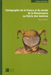
ISBN: 2717721762 2717727663 2717726284 9782717721768 Year: 2001 Publisher: Paris: Bibliothèque nationale de France,
Abstract | Keywords | Export | Availability | Bookmark
 Loading...
Choose an application
- Reference Manager
- EndNote
- RefWorks (Direct export to RefWorks)
Les quatre textes publiés dans ce volume concernent deux périodes importantes pour la cartographie française, la Renaissance et le Siècle des lumières, qui ont posé des règles pour la mesure et la description du territoire. Ces deux activités ont été pratiquées par des hommes de formations diverses – mathématiciens, ingénieurs, peintres, géographes – dont les talents étaient parfois concurrents et souvent complémentaires. Les uns ont proposé des méthodes dans le cadre de prestigieuses institutions comme le Collège royal (actuel Collège de France), l'Académie des sciences ou l'Académie de marine. D'autres étaient plus directement confrontés au terrain qu'ils devaient décrire pour différentes catégories d'usagers : juges, administrateurs, militaires, navigateurs, historiens, etc. Toutefois les uns et les autres ont œuvré, directement ou indirectement, pour le pouvoir royal, maître non seulement de la cartographie de la France, mais encore de la description du monde. Certes, le contrôle exercé par ce pouvoir et l'intérêt manifesté par les rois et leurs ministres ont pu favoriser les progrès de la cartographie et encourager la publication de documents illustrant les actions glorieuses du monarque et la grandeur de la France, mais ils ont aussi restreint la diffusion de certaines cartes dont l'importance stratégique était évidente. Même s'ils ne sont pas toujours apparents, les objectifs poursuivis par les cartographes et le mode d'utilisation de leurs productions sont toujours pris en considération dans ces quatre études, et ce indépendamment de la date de production des documents.
Cartography
---
Globes
---
Military engineering
---
Geografie
---
History
---
Cartografie
---
Historische Cartografie.
---
Cartography - France - History.
---
Globes - France - History.
---
Military engineering - France - History.
---
Geography
---
Earth & Environmental Sciences
---
#BIBC:ruil

ISBN: 2218717492 9782218717499 Year: 2007 Publisher: Paris Hatier
Abstract | Keywords | Export | Availability | Bookmark
 Loading...
Choose an application
- Reference Manager
- EndNote
- RefWorks (Direct export to RefWorks)
912 --- Woordenboeken - lexica --- French speakers --- Francophones --- Communication (langue espagnole) Communicatie (spaanse taal) --- Grammaire Spraakkunst --- werkwoordsvormen --- 81'366.3 --- werkwoorden --- Spaanse werkwoorden --- Spaanse werkwoorden. --- Didactics of Spanish --- Grammar --- Spaans --- Leermiddelen. --- Spanish language --- Espagnol (Langue) --- Verb --- Study and teaching --- Verbe --- Etude et enseignement --- spraakkunst (grammatica)
| Listing 1 - 10 of 26 | << page >> |
Sort by
|

 Search
 Feedback
 About
About Help
Help News
News